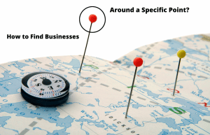
Table of Contents

Place of Interest Data: A Crucial Resource for Many Industries

A POI is a record of a location on a map, defined by its geographical coordinates, name, and category. It can be used for a wide range of purposes, from finding restaurants and hotels nearby to locating parks and tourist attractions.

POI data solutions are of interest to a variety of industries and sectors, including navigation and mapping companies, food delivery, logistics and transportation, insurance and financial services, retail, real estate, telecommunications, marketing and advertising, and government and public sectors. POI databases can be used for a range of purposes, such as identifying competition in a certain neighborhood, calculating shipping rates, optimizing the routing of fleets for better delivery times, and more.

POI data is a vital resource. However, obtaining this information can be an arduous task, requiring a reliable source that provides accurate and up-to-date data to ensure its usefulness and relevance. Without a trustworthy POI database, businesses may waste valuable time and resources collecting incomplete or inaccurate data, leading to suboptimal decision-making and negative outcomes. Therefore, selecting a reputable provider that can offer comprehensive POI data solutions tailored to a business’s specific needs is paramount.

Various sources provide POI databases, such as OpenStreetMaps, Google Maps, and government directories. Google Maps, launched in 2005, and started to be the most popular and revolutionary service for place of interests. Google Maps integration is the best choice for POI data due to its extensive coverage, position as the number one source for location information, and the keen interest of businesses to be featured on the platform. With over 120 million locations worldwide, Google Maps offers an unparalleled scope of information, ensuring that businesses have access to the most comprehensive and accurate data possible. 

Google Maps has become the go-to platform for both businesses and consumers, making it a crucial resource for companies looking to enhance their visibility and reach their target audience. For this reason, it would be best to use Google Maps data for the most up-to-date data.

Although this is the most accurate option, it is normally not possible to download Google Maps data directly from anywhere. This requires a solution. This is where Targetron comes into play.

Worldwide POI Data Source

Targetron is a comprehensive POI database that sources its data from Google Maps. With a global reach, Targetron provides up-to-date and accurate information on millions of locations worldwide. Its database covers a range of categories, including restaurants, hotels, tourist attractions, shopping centers, and more.

Designed to meet the requirements of various businesses and industries, Targetron’s Point of Interest (POI) data solutions serve a wide array of sectors. These include navigation and mapping, logistics and transportation, insurance, real estate, as well as marketing and advertising, equipping businesses with the necessary information to make informed decisions. To maintain accuracy and currency, the database at Targetron is consistently updated.

Targetron’s database is accessible through an easy-to-use web interface that allows users to search and filter locations based on their specific needs.

Downloading Datasets From Targetron​

Exporting datasets in Targetron is straightforward. Simply select the location and category. The dataset will be ready to export. Targetron also reports how many POIs it has before exporting it.

The entire dataset can be completely downloaded by selecting the location and category with the basic parameters. However, if a specially filtered and narrowed list is desired according to certain criteria, assistance can be provided by Targetron’s advanced filtering parameters.

The article “Getting Started With Local Businesses Directory” covers an examination of how to utilize advanced parameters and filtering based on specific criteria.

Thanks to its up-to-date data and handy filtering capabilities, Targetron can provide data suitable for many different industries and usage scenarios. Here are a few examples. 

Finding All Locations Of Chain Stores

Table of Contents Where Can You Find the Locations of Chain Stores? There are many brands and companies with hundreds of stores. It is a big problem to find all the branches of these companies

Read More »

If a POI dataset is needed, Targetron’s global database can now be explored. It is ready to meet all needs with pay-as-you-go pricing.

Try Targetron for POI Datasets and Databases

Targetron offers a comprehensive and trustworthy solution for businesses and industries seeking POI data. With its extensive database, ease of use, and commitment to accuracy, Targetron is a valuable resource for downloading POI datasets and databases. Explore the Targetron’s POI Database now.

FAQ

Most frequent questions and answers

POI stands for Points of Interest, which are locations that are marked as significant or interesting on a map. Examples of POI include restaurants, hotels, tourist attractions, parks, and shopping centers. Targetron is a comprehensive POI database that provides accurate and up-to-date information on millions of locations worldwide.

Google POI data refers to the data that Google Maps uses to mark specific locations on a map. Google Maps has over 120 million locations worldwide and has become a popular service for businesses to register their locations to make it easier for customers to find them. Targetron sources its POI data from Google Maps and offers a comprehensive and trustworthy solution for businesses and industries seeking POI data.

A POI system is a system that utilizes Points of Interest (POI) to provide information about specific locations on a map. POI systems can be used for various purposes, such as navigation, marketing and advertising, and logistics and transportation. Targetron offers POI data solutions that are designed to meet the requirements of various businesses and industries, providing accurate and up-to-date information on millions of locations worldwide.

In GIS (Geographic Information System), POI stands for Points of Interest, which are specific locations on a map that are marked as significant or interesting. GIS is a powerful tool that can be used to analyze and visualize spatial data. Targetron provides POI data solutions that serve a wide array of sectors, including navigation and mapping, logistics and transportation, insurance, real estate, as well as marketing and advertising.

POI data can be obtained from various sources, such as OpenStreetMaps, Google Maps, and government directories. However, obtaining accurate and up-to-date POI data can be an arduous task. Targetron offers a comprehensive and trustworthy solution for businesses and industries seeking POI data, providing an easy-to-use web interface that allows users to search and filter locations based on their specific needs.

POI data can be used for various purposes, including identifying competition in a certain neighborhood, calculating shipping rates, optimizing the routing of fleets for better delivery times, finding companies near specific coordinates, and more. Targetron’s POI data solutions serve a wide array of sectors, providing accurate and up-to-date information on millions of locations worldwide, equipping businesses with the necessary information to make informed decisions.